Executive Summary
Axion was commissioned by the Welsh Government to test the practical feasibility of land valuation methodologies in Wales, contributing to a wider programme exploring potential reforms to local government finance.
Previous research had examined land value taxation conceptually, but there was limited evidence showing how land valuation could be undertaken in practice using Welsh data and geographic conditions. This project aimed to fill that gap by producing applied case studies demonstrating how land values might be derived across different Welsh contexts.
The research was deliberately policy-neutral. It did not recommend taxation models or policy changes, but instead focused on testing whether valuation approaches can be applied using:
- Publicly available datasets
- Established professional valuation methods
- Transparent spatial and analytical processes
The work assessed four key questions:
- Feasibility: Can land values be estimated using existing data and methods?
- Scalability: Could approaches be extended beyond case studies?
- Reproducibility: Are methods transparent and repeatable?
- Comparability: Can results be interpreted across different geographic contexts?
Outputs included applied valuation case studies, spatial mapping of land values, and detailed documentation of methodological assumptions and constraints.
Overall, the project provides practical evidence to inform future policy discussions, demonstrating what land valuation can realistically deliver under Welsh conditions and where limitations remain.
Strategic and Policy Context
The research sits within a broader Welsh Government programme examining how local government finance could evolve to support sustainable and equitable revenue generation.
Earlier research, including the 2021 report Reforming Local Government Finance in Wales, identified land value as an area requiring further investigation. Although land value taxation is widely discussed in academic and international policy contexts, there remained a major evidence gap:
how land valuation methodologies would operate in practice within Wales.
Previous work focused primarily on:
- Conceptual taxation models
- International examples
- High-level feasibility discussions
However, policymakers lacked applied evidence demonstrating:
- How valuation approaches perform with real Welsh datasets
- How outputs vary across urban and rural geographies
- What assumptions are required to isolate land value from property value
- Whether methods could realistically be scaled nationally
The Welsh Government therefore commissioned applied research designed to move the discussion from theory to practical evidence.
A key requirement of the commission was policy neutrality. The project was not intended to recommend a tax or valuation system but to strengthen the evidence base for future policy consideration.
Key Analytical Challenges
Translating conceptual land valuation approaches into real-world analysis presented several challenges.
Data availability
The project relied exclusively on:
- Publicly available datasets
- Data already held by the contractor
- Data generated during the research
No bespoke datasets were provided by government or valuation authorities. This constraint intentionally tested real-world feasibility but created challenges such as:
- Limited evidence of land transactions
- Difficulty separating land and property values
- Inconsistent spatial resolution across datasets
- Uneven data coverage between urban and rural areas
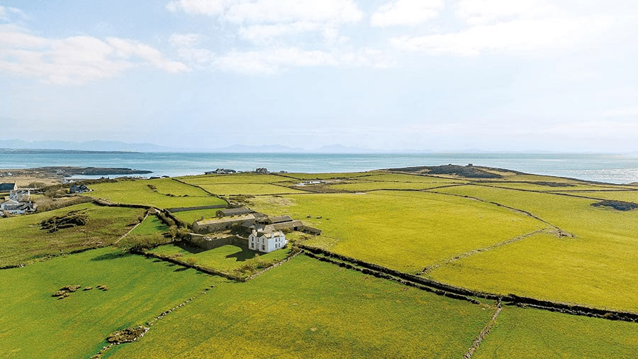
Geographic diversity
Wales contains a wide range of land types and market conditions, including:
- Urban centres
- Post-industrial towns
- Rural and agricultural landscapes
- Coastal and environmentally constrained areas
Valuation methods that perform well in one context may behave differently elsewhere, making comparability and interpretation more complex.
Separating land and built value
Land and buildings are typically valued together in professional practice. Estimating land value therefore requires assumptions embedded in approaches such as residual valuation or income-based methods. These assumptions introduce uncertainty and can affect reproducibility at scale.
Transparency and reproducibility
Because land valuation is politically sensitive, the Welsh Government required transparent and traceable analytical processes. All methods, assumptions, and data sources therefore had to be clearly documented, ruling out opaque or “black box” modelling approaches.
Research and Delivery Approach
Axion approached the commission as applied policy research designed to generate credible evidence under real-world conditions.
Four principles guided the methodology:
- Practical realism – methods were tested using data that could realistically be available at scale.
- Transparency – analytical steps and assumptions were clearly documented.
- Comparability – outputs were structured to allow comparison across case studies.
- Policy neutrality – findings were presented as evidence rather than recommendations.
Case study framework
The research was delivered through a case study methodology, applying defined valuation approaches to selected Welsh geographies.
Each case study followed a consistent analytical process:
- Defining the valuation approach
- Identifying and assessing relevant datasets
- Applying the method at a defined geographic scale
- Mapping and analysing results spatially
- Interpreting outputs, limitations, and scalability
This structure ensured results were consistent, comparable, and reproducible.
Application of Land Valuation Methods
Case study selection
Valuation approaches were applied across selected Local Super Output Areas (LSOAs) representing diverse Welsh conditions, including:
- Urban and suburban areas
- Rural and agricultural landscapes
- Locations with differing development pressures
- Areas with varied market activity
This diversity allowed the research to test how valuation approaches behave across contrasting geographic contexts.
Data preparation
Datasets were assessed based on:
- Geographic coverage
- Spatial resolution
- Accessibility and cost
- Relevance to valuation methods
Data preparation included spatial alignment of datasets, standardisation to common geographic units, and quality checks to identify anomalies or gaps.
Applying valuation methods
Valuation techniques were applied using transparent calculation steps and consistent assumptions across case study areas. Where professional judgement was required, it was explicitly documented and assessed for its implications for scalability.
Spatial Analysis and Mapping
Because land value is strongly influenced by location and surrounding context, spatial analysis was central to the research.
Mapping was used not only to visualise results but also as an analytical tool to:
- Identify spatial patterns in land values
- Detect anomalies or unexpected outputs
- Assess whether results align with known land use patterns
The analysis revealed substantial spatial heterogeneity, with land values varying significantly across Wales and even within small geographic areas.
Urban and rural markets behaved very differently, highlighting the importance of context-sensitive valuation approaches.
Key Findings
Feasibility
The research demonstrates that land valuation can be undertaken in Wales using existing data and professional valuation logic, provided expectations are realistic.
It is possible to:


